If you’re considering investing in property development, understanding the role of a land surveyor is crucial. These professionals provide accurate data that architects, engineers, and developers use for designing and planning infrastructure.
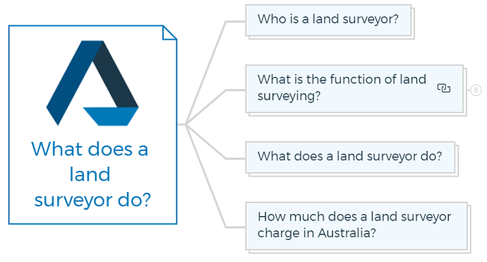
Who is a land surveyor?
A land surveyor is a professional who measures and maps the land and features of a property or area. They have a good understanding of mathematics and are trained to implement this knowledge in property development.
Apart from surveying the land, land surveyors also help measure bodies of water and aerial space.
You are missing out if you haven’t yet subscribed to our YouTube channel.
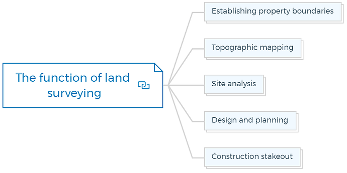
What is the function of land surveying?
Property development relies on accurate land surveying measures and data. Architects, engineers, and developers utilise this data to design and plan buildings, roads, and other infrastructure.
Here are some of the specific functions of land surveying in property development:
Establishing property boundaries
Land surveying establishes property boundaries. Property ownership and border disputes require this information.
Topographic mapping
Land surveyors create topographic maps to highlight land contours and characteristics. This data helps locate building and infrastructure projects.
Property Development “How To’s” & Frequently Asked Questions
Includes 5 x detailed eBooks [142 pages]
✓ How To Become A Property Developer? In 10 Easy Steps (51 Pages)
✓ How To Overcome Fear In Property Development? (15 Pages)
✓ How To Become A Real Estate Developer? Without Experience (37 Pages)
✓ Property Developer FAQs – Who, What, When, How? (20 Pages)
✓ How To Become A Real Estate Millionaire In 10 Steps? (19 Pages)
Site analysis
Land surveying offers information on soil composition, slope, drainage, and other elements that may impact building and infrastructure design and construction.
Learn More
Design and planning
Land surveying data helps architects, engineers, and developers design and plan structures and infrastructure. This involves locating buildings, roads, utilities, and other structures.
Construction stakeout
Land surveyors provide crucial construction stakeout services. To guarantee proper construction, buildings, roads, and other structures are marked on the ground.
Land surveying ensures that structures and infrastructure are developed in the appropriate location, design, and requirements.
What does a land surveyor do?
Before buying a property, it is often recommended to hire a land surveyor. Though hiring a professional costs money, it can also save you thousands of dollars.
Land surveyors explain your purchase. They show you the entire acquisition so you won’t be surprised by complex property borders, building limits, or legal requirements.
The land surveyor collects information and measures the environmental characteristics of land, such as open pit mines, coastlines, sea bottoms, and underground works.
This information is then shared with geographic information science specialists and cartographers who may utilise this data to analyse, model, map, plan, file, chart, and report.
Some of the specific tasks that a land surveyor may perform include:
- Measuring and mapping property boundaries using both traditional and modern methods.
- Determining the location of buildings, roads, and other manufactured structures.
- Identifying and mapping natural features such as topography, vegetation, and bodies of water.
- Researching and interpreting legal documents such as deeds and property maps.
- Providing data and maps for use in land-use planning, construction, and property development.
- Establishing land-use and zoning boundaries.
- Providing expert testimony in legal cases involving property disputes or boundary issues.
Additionally, land surveyors are responsible for ensuring that their work is accurate and compliant with local and state regulations.
How much does a land surveyor charge in Australia?
The cost of a land survey in Australia can vary depending on several factors, such as location, the project’s complexity, and the type of survey required.
In general, the survey cost can range from several hundred dollars to several thousand dollars.
It’s important to note that survey costs vary based on the location, size of the property, and the type of survey needed.
For example, a basic boundary survey of a small residential property in a rural area may cost around $1,500 - $2,500. In contrast, a topographic survey of a large commercial development site in a city may cost $10,000 or more.
Additionally, some other factors that can impact the cost of a land survey include:
- The level of accuracy required (e.g. a higher level of accuracy will require more time and equipment).
- The type of survey needed (e.g. boundary survey, topographic survey, etc.).
- The need for additional services, such as aerial mapping or underground utility detection.
- The amount of research and data interpretation required.
It is always recommended to contact a few land surveyors and get quotes for the specific project and then compare them to choose the best one.


